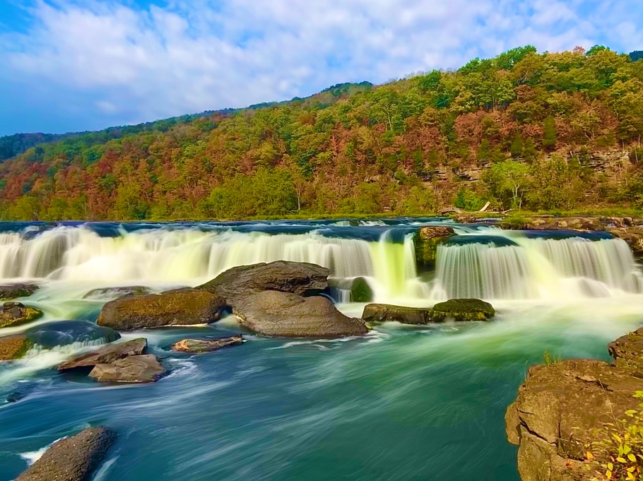
QUICK FACTS
- Location: Near Brooks, WV (Summers County)
- Elevation: 1,284 feet
- Coordinates: 37.756778, -80.906822 / (37° 45′ 24.4002″ N, 80° 54′ 24.5592″ W)
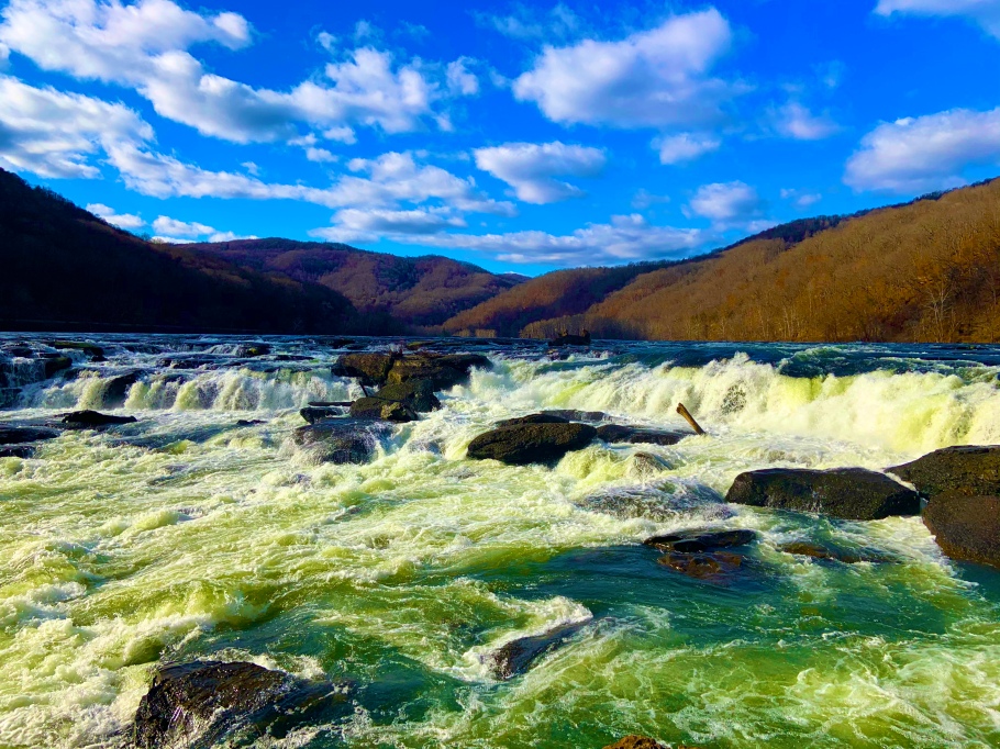
- Waterway: New River
- Height: 10-30 feet – spans the entire river and is separated by islands
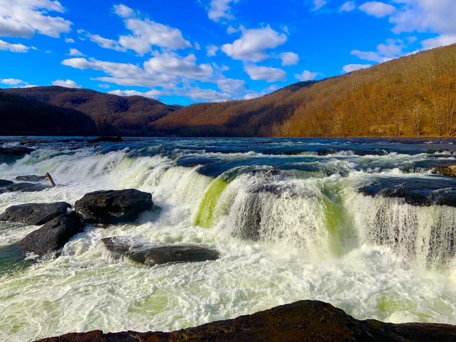
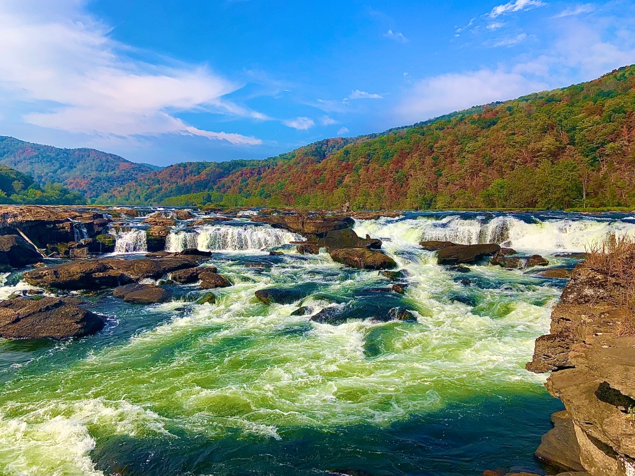
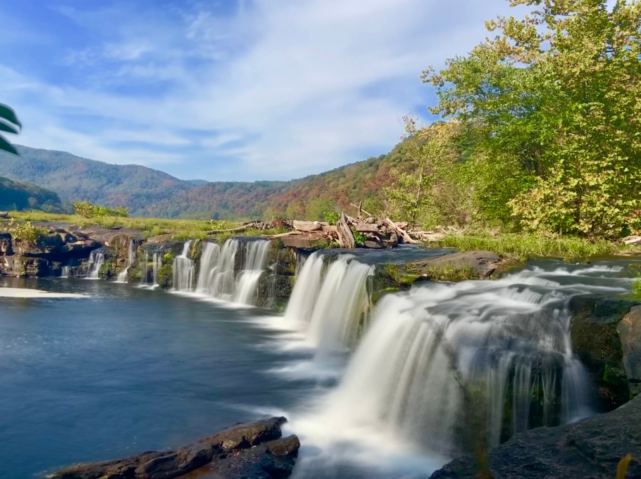
Sandstone Falls is truly the waterfall playground of West Virginia! It is a series of falls that spans across the entire New River between Brooks and Sandstone, WV. A photographer could spend an entire day photographing the area, as there are nearly a limitless amount of angles, shots, and views to take in at this spot. A person could simply enjoy some of the falls by walking an extravagant and newly-remodeled boardwalk, or by venturing off onto a fisherman’s trail for an even closer look at the falls – which I highly recommend!
During this trail, you will encounter three creek crossings, the first of which is the deepest. The key is to stay on the lower end of the stream crossings toward the river, as I’ve found this to be the easiest way to cross. Trails on each side of the crossings should help you with your preferred crossing spot. During typical water levels, the flow is not bad, but the rocks are very slick, so take it slow!. When the New River is running high, this and the other crossings can become quite dangerous, so proceed at your own discretion! Once you cross the third crossing, you will encounter a couple of rocks that may require a small climb (it’s not difficult, but too high to to jump). You will then be awed in what is in front of you once you reach the falls that lay just ahead.
If you search Sandstone Falls in Google Maps to travel to, you might get directions to take a road called ‘Irish Mountain Road’. I would advise against this, unless you have a 4-wheel drive vehicle. I did not know this when I took my Dodge Dart down to Sandstone for the first time, and it was a bit harrowing to say the least. Head off I-64 at the Sandstone/Hinton exit instead (Exit 139), and drive 10 miles south on Route 20. Once in you’re in the historic town of Hinton, turn left onto 2nd Avenue, turn right again on Route 20 and cross the New River, and then turn right onto Route 26 (New River Road) at the end of the bridge. You’ll reach Sandstone Falls in 8.2 miles. There are other places to view and explore waterfalls in this area!
Sandstone Falls Location