QUICK FACTS
- Location: Glen Ferris, WV (Fayette County)
- Elevation: 686 feet
- Coordinates: 38.147408, -81.214220 / (38°08’50.7″N 81°12’51.2″W)
- Waterway: Kanawha River
- Height: Around 20 feet
The photos on this website are shot using an iPhone, and this is an instance where you are limited by that, as there’s no real way to get close to Kanawha Falls without a boat – so a good zoom lense on a DSLR would be a great companion to shoot Kanawha Falls.
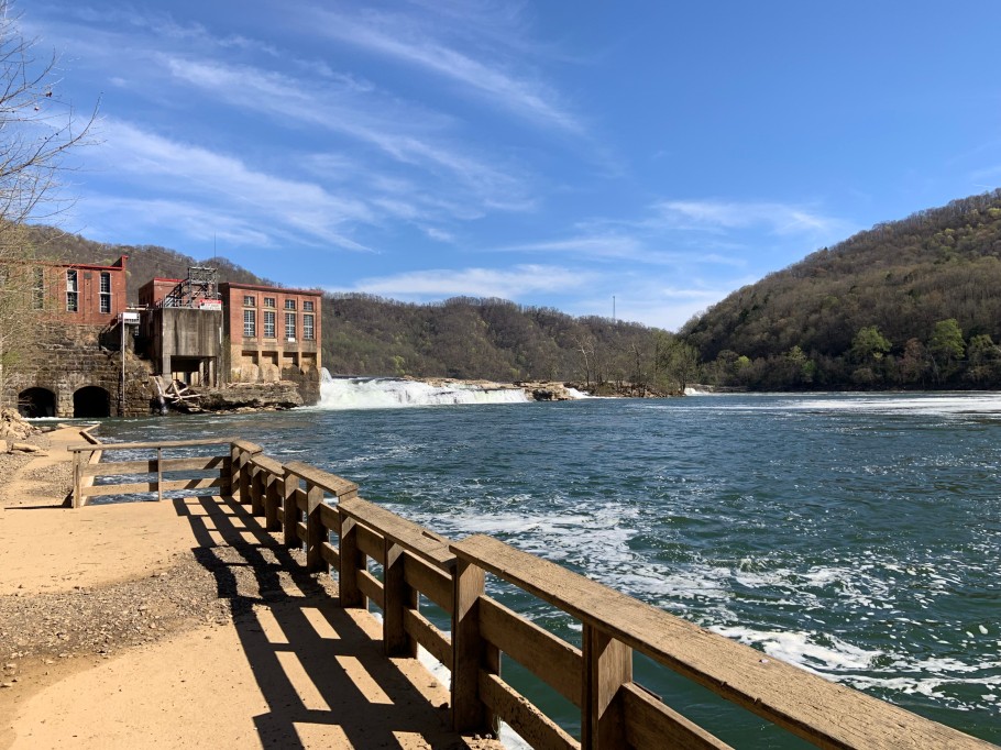
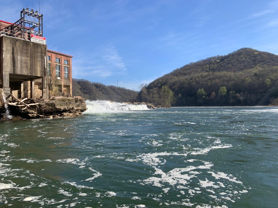
Kanawha Falls is an enormous waterfall in Glen Ferris that powers a hydroelectric plant (shown in the photo to the left). The hydroelectric plant was built in 1899 and is still operational.
There is a parking lot area for you to enjoy Kanawha Falls, along with picnic tables, as well as a walkway that will take you up to where I captured the photos shown. To get to Kanawha Falls, drive on Route 60 to the town of Glen Ferris. If you’re heading east, you’ll come across the parking area before the hydroelectric plant. You can’t miss it, as it’s a huge parking lot. Keep in mind that during periods of time where the Kanawha River is running high – that parking area does sit low and does flood. If you drive past the hydroelectric plant and the Glen Ferris Inn heading east, you’ve driven too far.
Kanawha Falls Location