QUICK FACTS
- Location: Near Lansing, WV (West Virginia)
- Elevation: 1,723 feet
- Coordinates: 38.058289, -81.06205 / (38° 3′ 29.8404” N, 81° 3′ 43.38” W)
- Waterway: Fern Creek
- Height: Around 50 feet
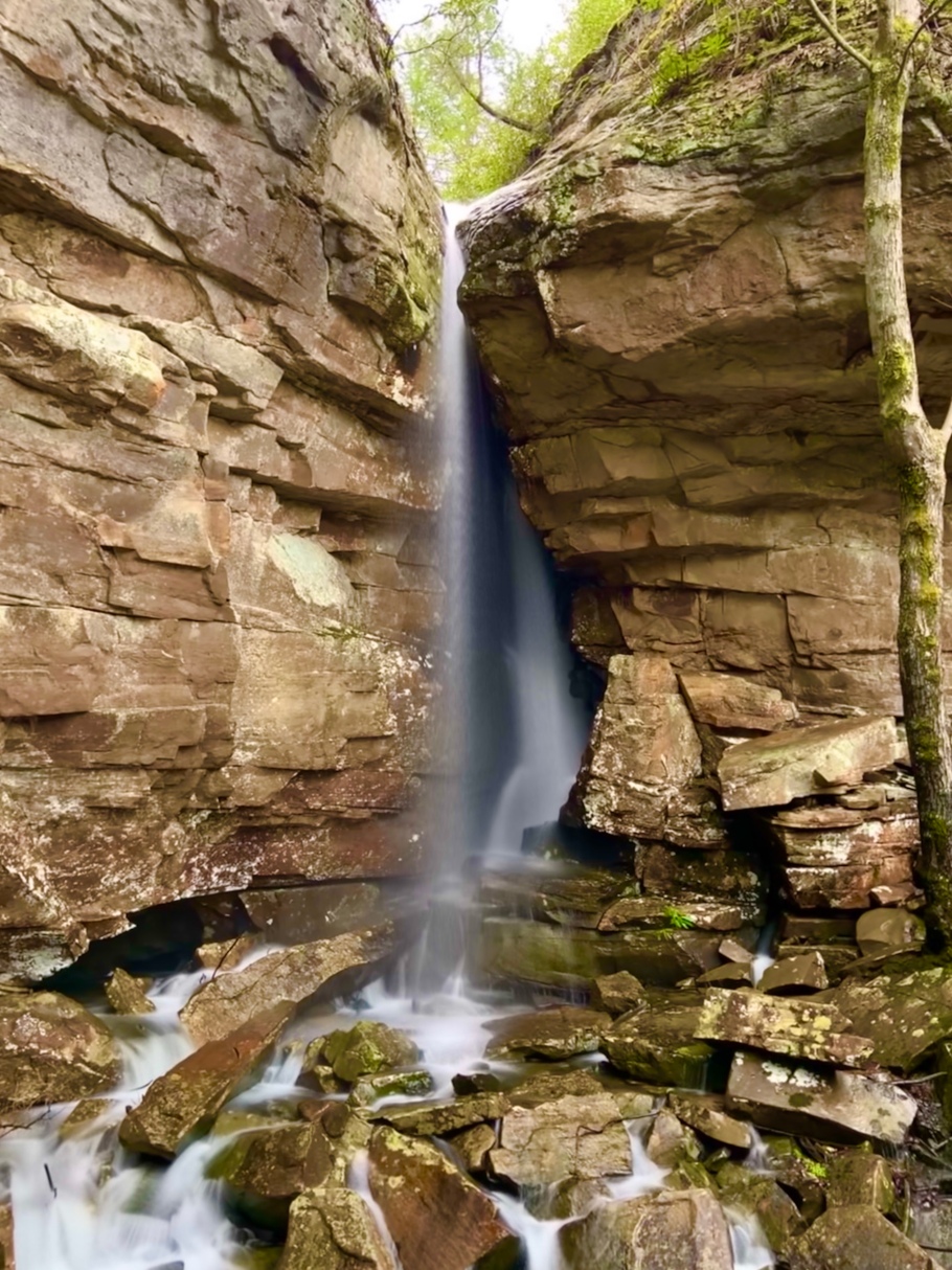
Upper Fern Creek Falls is a jaw-dropping waterfall, and is the first in a series of falls located on Fern Creek in Fayette County. WV waterfall enthusiast Ed Rehbein named this waterfall ‘Matteus Falls’ and I plan to keep that name. The waterfall is sensitive to periods of dry weather. When it hasn’t rain a lot, the waterfall shrivels back into a cleft, and is much less impressive. But when it rains, the waterfall emerges from the cleft, and drops several stories down to a pile of rocks below! It is one of the most unique falls I have visited!

There are two ways to access Fern Creek and explore the falls. These falls are not easy to access – it takes a lot of effort. There are house-sized boulders, occasional areas of rotten ground between boulders, and not to mention, it is very steep in places. The first way to access is to drive down Fayette Station Road about halfway down to the river. There is a very sharp turn to the right, and at this spot, there is a visible trail where you can park and then hit the trail. Going this way, you will want to hug the boulders that make up the endless wall essentially until you hear Matteus Falls. Then it will be time to begin your steep descent down. The second way to access is to drive down Fayette Station Road to a railroad crossing where Fayette Station Bridge is. There is parking here. Walk up the railroad tracks about a half mile, and you will see where Fern Creek empties out, and under good rainfall, hear the Lower Falls. I prefer going this way, but BEWARE – trains are active on these tracks. Pay very close attention!
Upper Fern Creek Falls Location