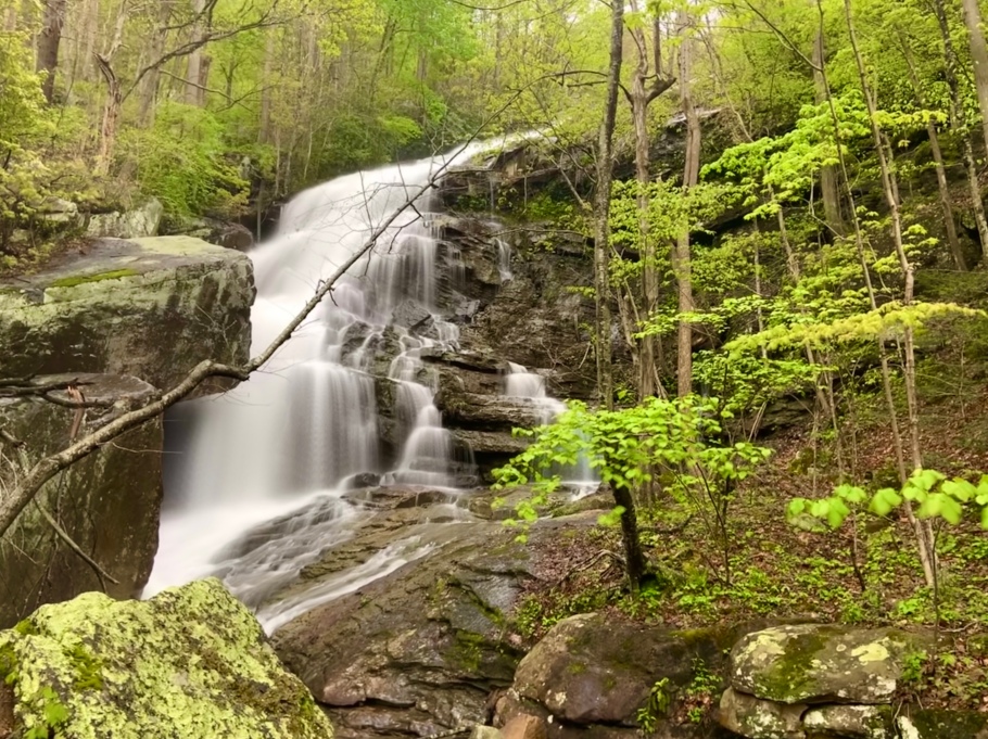
- Location: Near Lansing, WV (West Virginia)
- Elevation: 993 feet
- Coordinates: 38.057658, -81.067925 / (38° 3′ 27.5688” N, 81° 4′ 4.53” W)
- Waterway: Fern Creek
- Height: Around 45 feet
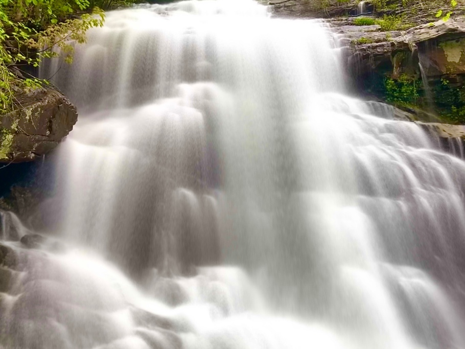
This waterfall is an absolute monster! As Fern Creek approaches its emptying into the New River, it encounters one more massive drop! If you are careful, you can grab a shot showing the entire fall’s beauty, and then you can hop up close and personal in the bottom two images – but be careful!
There are two ways to access Fern Creek and explore the falls. These falls are not easy to access – it takes a lot of effort. There are house-sized boulders, occasional areas of rotten ground between boulders, and not to mention, it is very steep in places. The first way to access is to drive down Fayette Station Road about halfway down to the river. There is a very sharp turn to the right, and at this spot, there is a visible trail where you can park and then hit the trail. Going this way, you will want to hug the boulders that make up the endless wall essentially until you hear Matteus Falls. Then it will be time to begin your steep descent down. The second way to access is to drive down Fayette Station Road to a railroad crossing where Fayette Station Bridge is. There is parking here. Walk up the railroad tracks about a half mile, and you will see where Fern Creek empties out, and under good rainfall, hear the Lower Falls. I prefer going this way, but BEWARE – trains are active on these tracks. Pay very close attention!
Lower Fern Creek Falls Location